Specifications of earth observation images differ among satellites, sensors, and distribution systems, so the hurdles of cross-sectional using of the data are still high.
Therefore, we are developing the satellite data distribution service, "JAXA Earth API", which enables developers and researchers to use JAXA's multiple satellite data easily in programming environment such as Python and JavaScript.
The datasets includes JAXA's public datasets and other agency's public datasets converted to COG (Cloud Optimized GeoTIFF), and so on. Over 90 datasets are available!
The Global Satellite Mapping of Precipitation (GSMaP) datasets are available, which shows the global precipitation, by using data from the GPM core satellite, meteorological satellites around the world and so on.
It contains data (monthly, half-monthly and daily averages) for over 25 years since March 2000.
Monthly
Half-monthly
Daily
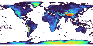
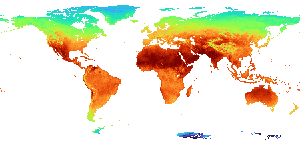
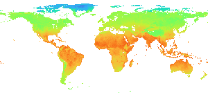
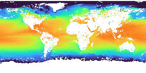
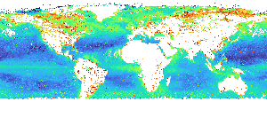
Land Surface Temperature
Land surface temperature (LST) observed by the Global Change Observation Mission - Climate "SHIKISAI" (GCOM-C).
When there are clouds, observations are not possible and data is missing.
JAXA Earth API publishes data with a spatial resolution of about 5km.
Daytime data was observed around 10:30am local time in each area, and nighttime data was observed around 10:30pm local time in each area.
Daytime / Monthly
Nighttime / Monthly
Daytime / Daily
Nighttime / Daily
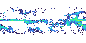
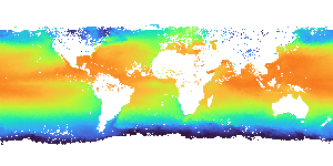
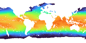
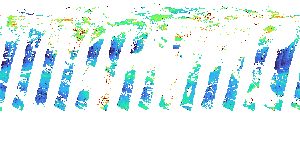
Sea Surface Temperature (by GCOM-C)
Sea surface temperature (SST) observed by the Global Change Observation Mission - Climate "SHIKISAI" (GCOM-C).
It is characterized by its ability to observe coastal areas with a spatial resolution of approximately 250m.
When there are clouds, observations are not possible and data is missing.
JAXA Earth API publishes global data with a spatial resolution of approximately 250m. Daytime data was observed around 10:30am local time in each area, and nighttime data was observed around 10:30pm local time in each area.
Daytime / Monthly
Nighttime / Monthly
Daytime / Daily
Nighttime / Daily
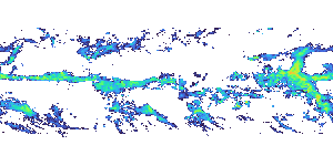
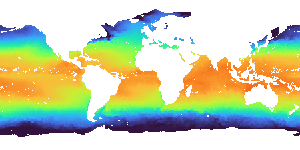
Sea Surface Temperature (by GCOM-W)
Sea surface temperature (SST) observed by the Global Change Observation Mission - Water "SHIZUKU" (GCOM-W).
It can be observed even when there are clouds.
The spatial resolution is lower than that of GCOM-C, and data is missing near the coast because it cannot observe.
Daytime data was observed around 1:30pm local time in each area, and nighttime data was observed around 1:30am local time in each area.
This data uses a 5-day moving average to reduce missing values due to outside the observation range, etc.
Daytime / Daily
Nighttime / Daily
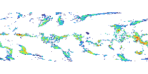
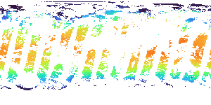
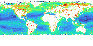
Chlorophyll-a Concentration
Chlorophyll-a concentration (CHLA) observed by the Global Change Observation Mission - Climate "SHIKISAI" (GCOM-C).
It shows the distribution of phytoplankton.
It is characterized by its ability to observe up to the coast with a spatial resolution of about 250m. When there are clouds, observations are not possible and data is missing.
JAXA Earth API publishes global data with a spatial resolution of about 250m.
Monthly
Half-monthly
Daily
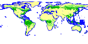
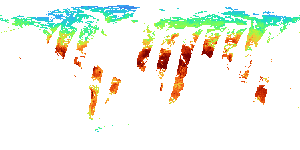
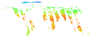
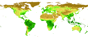
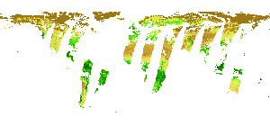
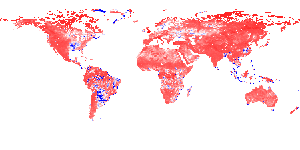
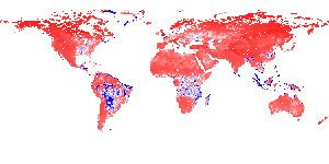
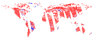
Normalized Difference Vegetation Index
Normalized difference vegetation index (NDVI) observed by the Global Change Observation Mission - Climate "SHIKISAI" (GCOM-C).
It shows the distribution and health of plants (leaves).
When there are clouds, observations are not possible and data is missing.
JAXA Earth API publishes data with a spatial resolution of about 5km.
API that runs on the client side is developed and disclosed, which allows users to check and change the process as needed. The API can acquire metadata of any layer and satellite data of any area and date.
Python API
Python API is available! The API has QGIS interface to acquire and display satellite images.
The JAXA Earth API currently has no restrictions on user registration, API key issuance, or the number of times the API can be used. Under the following conditions, the API module can be used free of charge in a variety of development environments. Also, modifications are possible for open source modules.
For the license of each data, please refer to the license information defined on the respective STAC. Commercial use is permitted for data to which the "Terms of use of research data" has been applied.
However, the API and database are provided on an “AS IS” BASIS and are subject to change without notice. JAXA/EORC does not guarantee the accuracy, integrity, reliability, operation, etc. of the database and the API. JAXA/EORC are not responsible for any event or accident caused by the use of this API or modules or databases. The use of the API and the database in a manner that is offensive to public order and morals or otherwise inappropriate in terms of social norms is prohibited.
If you intend to publish your results using the API in a paper, website, etc. or if you intend to release software incorporating the API module, please indicate so in the text (Example: “The data used in this paper have been obtained using the JAXA Earth API” “Image: Created using the JAXA Earth API” “The JAXA Earth API for Python module has been used”).
These license terms are subject to change without notice. For any inquiries about the terms, please contact us.