Using the API as MCP Server Tools in Claude Desktop
This page explains how to install the jaxa-earth package in a local Python virtual environment, configure Claude Desktop to use a local MCP server, and verify the integration on your PC.
Set Up a Virtual Environment
Open PowerShell (recommended) or Command Prompt. From a working folder, create a venv:
Activate the venv:
Install the API:
Install the additional MCP dependency:
Prepare the MCP Server Script
Download mcp_server.py and copy it into a stable path inside or reachable from your environment.
Common placement choices:
- The working folder alongside the venv
C:\YOUR-WORKING-FOLDER-PATH\mcp_server.py
Make sure the Python interpreter referenced in the configuration points to the venv Python executable:
Configure Claude Desktop
Open Claude Desktop and go to:
Settings → Desktop app → Local MCP servers → Edit config
Add the following configuration:
{
    "mcpServers": {
        "jaxa_api_tools": {
            "command": "C:\\YOUR-WORKING-FOLDER-PATH\\venv\\Scripts\\python",
            "args": ["C:\\YOUR-WORKING-FOLDER-PATH\\mcp_server.py"]
        }
    }
}
commandmust be the full path to the Python executable inside the venv.argsmust include the full path tomcp_server.py.
Restart Claude Desktop
Completely exit Claude Desktop.
Warning
Even after closing the application window, Claude Desktop may still be running in the background. Make sure it is fully stopped before restarting.
After restarting, verify that the tool is enabled in the MCP tools panel.

Available Tools
Once enabled, the following four JAXA Earth API tools are available in Claude Desktop:
| Tool | Description |
|---|---|
search_collections_id |
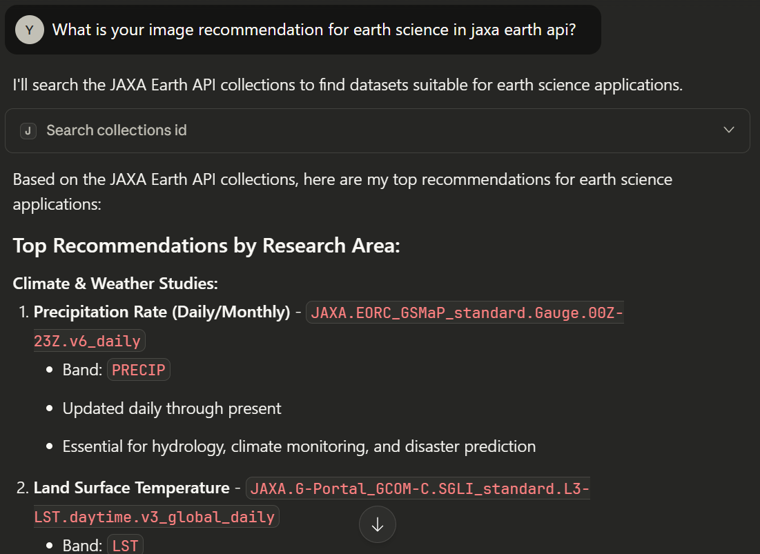
Return JAXA Earth API's detailed collection information. |
show_images |
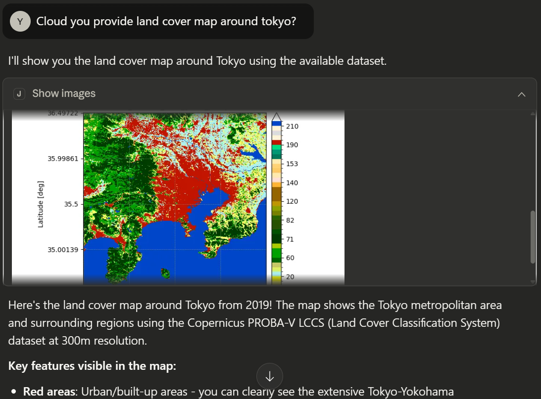
Show satellite image using JAXA Earth API based on user input. |
calc_spatial_stats |
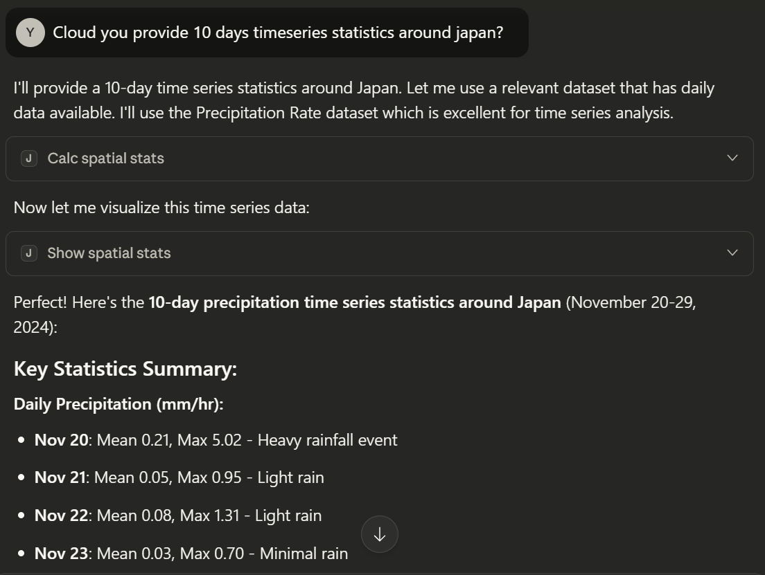
Calculate satellite data's spatial statistics values based on user input. |
show_spatial_stats |
Show satellite data's spatial statistics result image based on user input. |
Sample Questions